Posted by: okierus1 | March 6, 2010

2010 Ball Tigers

The IAEA Ball was held in February, again at the Hofburg Palace.  This was our second ball, and the first that we joined the “Ball Tigers” in the Festsaal.  Ball Tigers are a real Viennese phenomenon, people that aggressively go from Ball to Ball during the Season.  And I do mean aggressive, it was tough to fight our way to our seat!

Jesse, ready to go!


We had a preball party at the lovely District 1 flat of Heather and Greg.  Here is a photo album created by one of the party-goers – thanks Mimi!  Their elevator was out, so there are shots of well-dressed people trudging up 6 flights of stairs, but the journey was well worth it!

Mimi’s Pix:  http://share.shutterfly.com/share/received/welcome.sfly?fid=b0a65a7324f8bdaa&sid=1EctWbRy4YsYu

Unfortunately, neither cameras nor downloads worked out for this blog, so it is well worth it to check out Mimi’s photos above.

We walked from the party over to the Hofburg, refreshed along the way.

Zana outside the Hofburg

Here is the grand staircase into the Festsaal, Monika and Russel looking great.

The Festsaal is where the big opening show is put on each year, before everyone disperses into their favorite rooms.  This year it started out with a traditional Korean drum band, complete with ribbon dancer hats.

Korean Drum Band

After the Korean band, the 2010 Debutantes made their entrance.  They start the Ball proper, with a traditional Viennese Waltz.

the Debutantes and their escorts

Russel and me

One more thanks, this shout out to the Hong Kong Tailor, Russel looks pretty suave in the new tux!  It was a very nice evening, fun to be in the Festsaal; but next year, back to the Rock and Roll room!

Posted by: okierus1 | February 21, 2010

Home Sweet Home Leave

Jesse on the plane!

This past summer, as some of you are aware ,we got to travel back to the USA on home leave. We did the New Mexico, Oklahoma,  Arkansas tour (by way of Vienna-Frankfurt-Denver- Albuquerque/ Tulsa-Chicago-Frankfurt-Vienna). It was great fun except for the massive case of poison ivy Russel got..more on that later. We wanted to put up a blog just to show our appreciation to our family and friends! We arrived in Albuquerque mid-July, just about sundown. It just felt right when we got off the plane after that long, long ride..about 26 hours from the time we left our house in Langenzersdorf until we touched New Mexico terra firma!

New Mexico

Home Leave..Yeah!!!!

sweet NM sunset

We made our way to the east mountains and to our friends Tod, Kathy and Jada’s house (the Monks). The drive was like a trip down memory lane..how many times have we travelled this stretch of road..I can’t count.

We stayed with Tod and Kathy in their beautiful home for several days and they hosted a party for us..we love you you guys!

Jesse and Jada

Jada! Tod and Kathy's little angel!

 We went to the Santa Fe Farmers’ Market…

Kathy, Jada and Tod in Santa Fe

 Our friends Tom, Melanie and Marie Menard also put us up for a few days. Tom and I got in a hike. Tom built their house..a geodesic dome..super nice..with spectacular views…not to mention Tom’s art.  And Jesse and Marie, friends since Mrs. R.’s class..

Jess and Marie!

Tom and Melanie

Dome sweet Home!

Tom in his kitchen!

We got some quality time with our friends Don and Patti and Alex. We went to the metropolis of Bibo NM ..out to the Ammonite Ranch for some garlic!

Buttes and Mesas near Bibo NM

Don and Patti at Rancho de Ammonita

Nice Geology!

Alex!

 Photographers and artists come from around the world to New Mexico. I am convinced it’s the light…

La Luz

Anna Bill and Karen at the Rancho de Ammonita

NM Garlic

We got a chance to stop by our house which we are renting out right now. We have a wonderful tenant, Paula!!! We have great neighbors too. Thanks Bruce and Kathy!!!!

Our House and rainbow

 We saw lots of our friends, including the Sanchez family…Dan I think about you often …

Dan,Julie and Kendrick

Erik and Jackie

 I got to see my brother, Rick.

My bro Rick

Tom and Tod

Brother Rick

My bro Rick ,Bill and Leah

My favorite guitarist..Bill Pearce..on the road

Jess and Frankie (Bill and Tammie's daughter)

Then our friend Denise took us in.  She has BIG dogs!

Denise and Hannah

Karen on vacation!

Denise

 We did some great hikes in the Sandia Mountains behind our house.

Limestone, Granite and Clouds

Karen on the trail

Sandia Vista

Tom on the trail

Sandia Crest Trail

New Mexico

Taking care of the Edges was a group effort..THANKS ALL !!!

 Oklahoma

 Next stop Okieland! We drove I-40 accross the Texas panhandle to OKC then up I-35 to  just outside of  Newkirk  near the Kansas state line. This is wheat and cattle country. Dad and Mom have a little ranch..its very peaceful and relaxing for me. It is quite different for me coming to Mom and dad’s now. During my childhood we always lived in small towns in Oklahoma with the exception of a three year stop in Georgia  which was a larger town. While we visited my grandparents and Aunts /Uncles on their farms in southeast Oklahoma  I never really experienced living in the country on a ranch. I can see the appeal.

Dad watches while Blackie gets new shoes!

One nice thing about Dad’s place is the fishin’

Quality Time!

Always nice to see the kinfolks! my grandniece…

Ella Grace

and grand nephew..Jeez I’m getting old! Does he look like Mat or what!!!

Dilon

Mat..Dilons dad and my nephew

Tera (love of Mats life) dad and sis

My sister Deb

 We took a little side trip down to “Greater Adar” (Ada, Okla.) to visit my college buds Randall and Deb Ross. I can’t believe how big their kids are.

Jesse and the Ross family

Randall works at the US EPA’s Kerr laboratory. He’s a high powered PHD Okie Groundwater Scientist! Deb is quite the geologist in her own right and we really appreciate having them as our friends!!  Thanks for the hospitality!  They are the blondist of the blond, it is quite amazing…

Deb and the kids!

Next stop was Woodford Oklahoma near Ardmore…I’m sure you all know where thats at.. where we visited our friends  the Fore’s (featured in this years Christmas blog!).  Blane is growing a world class crop of poison ivy on his 100 ac. spread. I managed to survive this until the plane ride back to Europe. The itching was almost unbearable on the 22 hour trip..whoever said calamine lotion would help is full of it!!! The skin doctor specialist over here in Vienna was delighted to see me and treat this case as he had always heard about poison ivy but had never seen a case in person! But I digress…Blane and Tammy are building their own home and it is going to be beautiful. Blane has cut and selected his own red cedar logs from the area and collected rock fom his property for the outside wall on the first floor. The house is built into a hillside and is partially under ground with a second story log cabin look. Nice! They took us to an awesome BBQ place and a  brief stop at Turner Falls. Thanks guys..we love ya!!!

From Blane and Tammy’s we visited my relatives in southeast Oklahoma north of Atoka on highway 69. We stayed with my cousin Patti and Aunt Jessie and our family. My Uncle Junior and Aunt Barb live across the road in my grandparents old home place albiet significantly improved. I have many many good memories of here in the summers when my folks used to let us stay for a couple of weeks.  Thank-you from the bottom of my heart Junior, Jessie, Patti and all of you dear kin! I may rarely get to see you but I think of you often.

Cousin Patti,Uncle Junior,Aunt Barb,Aunt Jessie and Mom

Dad, Mom and Aunt Jessie

Patti her grandaughter madeline and her mom,my Aunt Jessie

Arkansas

We then proceeded to Arkansas and the area around Fayetteville. We stayed with Karen’s mom and some with her Dad too. Many of our relatives on Karen’s side of the family live in and around here. We visited, we fished, we swam, we ate…we had a great time. My sister in law and brother in law are great and I love their kids..good job ya’ll.  

Jeanne, Rachael and Gabe

We had a picnic for Jesse’s 14th birthday. She wanted to go with her family to the lake.

The birthday girl!

Karen's dad..Lou

The party was at Shores Lake..Actually, that’s Lew.

swimming in Shores lake

Gabe, Kevin and Donna

Now no trip to Arkansas would be complete without a little possum petting!  (okay the proper name is opossum)Vivian Stockton, longtime family friend of Karen’s, cares for animals which need to be rehabilitated before they can be released back to the wild.

A girl and her possum!

Mrs Stockton and Jesse

Jesse and Rachael..and a possum!

Opossums usually live in wooded areas. However, they are  also present in parks and cities. Their range has grown since the arrival of Europeans in North America. They are our only north american marsupial. Possums are nocturnal loners. They can swim well and climb with the help of their gripping tail. Sometimes they hang on branches with their tails. They live mostly on the ground. They inhabit a particular area for a few months and move on. Among the natural enemies of the opossum are coyotes, foxes, and birds of prey(see below). When threatened, they feign death hence the expression “playing possum” .

Me and Jess

Mrs. Stockton does not have as many animals as she used to. But she still has a few.

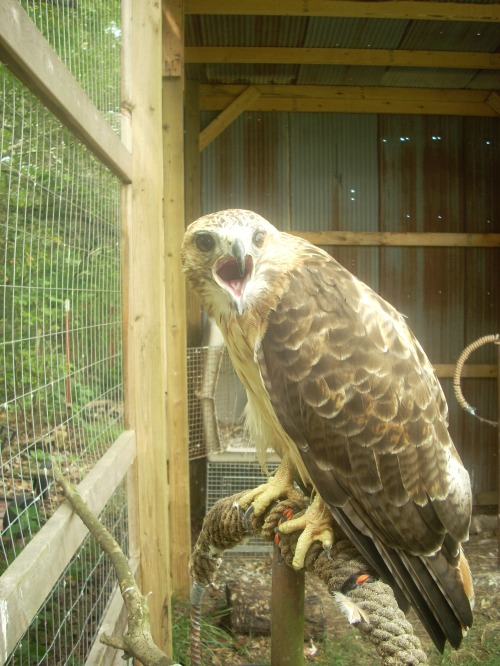
Red tail Hawk

 “Where’s that possum?!”  OK, Back to Austria

67 Kellergasse

THANK YOU ONE and ALL FRIENDS and FAMILY!!!!!!!!!

Posted by: okierus1 | February 15, 2010

February in Langenzersdorf

It’s cold, it’s snowy, it’s dreary.

Is it still 27 degrees F?

At least on the porch, the snow is still white.

Where is the patio furniture?

But, we do what we can.

Staying fit, always better with 8 oz. weights

 Well, I guess this snow is good for something after all.

Happy Valentine's Day!

Posted by: okierus1 | February 14, 2010

Second Christmas 2009

It’s hard to believe another year has come and gone. We have now celebrated two Christmas’s here. This year was really special as we had our friends the Fore family (Blane, Tammy and Addie) all the way from Woodford Oklahoma in for a visit. Many of the pictures featured in this blog are courtesy of Tammy. Blane is my longtime bud from Okie State University.

A Little Austrian Cuisine

After a long flight and brief recovery we took the Okies out for some traditional austrian food. We went to the Melker Stiftskeller. 

The Melker Stiftskeller is part of the Melkerhof district in Vienna’s Schottengasse . In this place there used to be a house with a garden, which was purchased by the Abbey of Melk on July 10th, 1438 Abbot Sigismund had a chapel erected in 1520.
During the first Turkish siege in 1529 the Melkerhof was damaged. In the following year the building was enlarged and a tower was constructed. From that tower  defenders of the city observed the movements of the Turkish enemy during the second Turkish siege. Based on these observations a tunnel was dug from the cellar – Melkerhof to the enemy lines. The Melkerhof itself served as a hospital during the siege.
Later the Melkerhof was enlarged to five buildings through the acquisition of adjoining houses. All of the buildings were pulled down in 1769 under Abbot Urban II, following a wish of the Empress Maria Theresa. In their place the new Melkerhof, which was finished in 1774, was built. Furthermore a new chapel was built and furnished with frescos by Johann Bergl and altarpieces by Johann Schmidt, better known as Kremserschmidt.
A certificate from 1629 proves that there was a wine-cellar connected with the Melkerhof already at that time. In addition it confirms the right of the Abbey of Melk to store and sell wine from the Abbey’s wineyards.
The Melker Stiftskeller with its exquisite cuisine developed out of this wine-cellar. It not only offers great wines, but is also well-known for its crisp roasted pork knuckles…yummy!

In the Keller !

Next was a trip over to Obertauern..an excellent ski area near Salzburg. Blane and I drove over (about 4 hours) and the girls took the train.

A Teen

 The train allows for some nice views of the countryside.

Alps

A Train Station

Kirche

Addie and Jess on the train There are 26 lifts..seven major peaks..we skied six..they claim to be able to move 4700 people per hour up the ski area..we were there the week before Christmas and the place was relatively empty.A ski bunny on the train!

Ski Babes!!!

Jesse and her new board !

 According to Jesse skiing is for old people!

What a view!

Ah Obertauern !

Addie and Jesse

Me and the wife

Happy Okie

After a three day ski adventure and a minor knee injury we limped back to Langenzersdorf to celebrate Christmas!

Our Tree

The Christmas Buddies!

We decided to do a couple of Christmas markets which are always fun this time of year..the lights, the decorations..the gluhwein!

Christmas Market and Natural History Museum

Public transportation around Vienna is great.

Me and Blane on the U-bahn

Fore Family at a Christmas Market

We did a little sightseeing….Belvedere palace ..with the famous Gustav Klimt collection, Schonbrunn palace… sometimes in the snow.

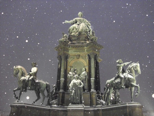
Snowing on Maria Theresa & co.

The Naturhistorisches Museum (natural history ) my personal favorite.

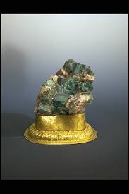
Addie and the Amethyst

 The museum is fantastic, an unbelievable mineral collection such as the geode Addie is standing by. The taxidermy collection features over 30,000 specimens. You can see rare fossils and gigantic dinosaurs, as well as famous prehistoric works of art. One of the most important is the 25,000 year-old figure of “Venus of Willendorf”, the skeleton of a Diplodocus, the longest terrestrial vertebrate that has ever lived, a giant topaz weighing 117 kg and the bouquet of valuable jewels which Maria Theresa (Habsburg emperoress) had made as a present for her husband.

Gold and Calcite

Gold Nugget!!!

Natural History Museum in Winter !

Once the ham had settled after Christmas (great dinner Karen!) over the next few days we went ice skating (some of us)..a little hiking in the Bisamberg (the hills and woods around the house) and to a chinese food place in our village..oh yeah..there’s a ten pin alley

Christmas Market at Schonbrunn

Rathaus Christmas market

Girlfriends

It was a wonderful holiday break..thanks Blane, Tammie and Addie for coming to see us!  We miss you!!!

Okay..who’s next?

Posted by: okierus1 | January 24, 2010

Hungary

In November 2008 (I know its a bit late..I still think the pictures are interesting..) I had the opportunity to travel to Hungary on a combination business/pleasure trip. I fell in love with the country and the people. I travelled by van with my long time friend Alex Jakubik. We went to Pecs by way of Lake Balaton from Vienna. On the return we passed thru Budapest and visited some of his relatives and did a little sightseeing.

A little Hungarian history may be of interest. Following a Celtic (after c. 450 BC) and a Roman (9 BC-430) period, the foundation of Hungary was laid in the late 9th century . In the year 1000 King Stephen I was crowned with a crown sent  by the Pope from Rome. After being recognized as a kingdom, Hungary remained a monarchy for 946 years, and at various points was regarded as one of the cultural centers of the western world. Hungary was partially occupied by the Ottoman Empire in the 16-17th centuries, after which it became part of the Habsburg Empire and later a constituent  of the Austro-Hungarian monarchy. A major power until the end of WWI, Hungary lost over 70% of its territory, along with 3.3 million people of Hungarian ethnicity under the  terms of the Treaty of Trianon, which were considered excessively harsh by many in Hungary. The country also lost five of its ten largest Hungarian cities. The kingdom was succeeded by a Communist era (1947–1989) during which Hungary gained widespread international attention regarding the Revolution of 1956 and the seminal move of opening its border with Austria in 1989, thus accelerating the collapse of the Eastern bloc.

In terms of land area it is slightly smaller than the US state of Indiana. The flag looks like this:


So east we headed towards the Hungarian town of Pecs in Alex’s van to the sweet music of Ella Fitzgerald!  In a short time we came upon the castle of Csesznek.

Castle Csesznek

The medieval castle of Csesznek was built about 1263.

Me and the Castle

In 1561 defenders of this castle successfully repelled the siege of the Ottomans, only to have it fall into Turkish control in 1594.  By 1598 the Hungarians had recaptured it.

Feel the History

As I stood there, I remember thinking this castle was built 500 years before the American Revolution!  I wondered who throughout history had shared this same view? We arrived at Lake Balaton a couple of hours later after a wonderful drive through the rolling hills of the Hungarian countryside.

Lake Balaton

Lake Balaton is the largest lake in Central Europe, being approx. 78 kilometers long and averaging 8 kilometers wide. It is fairly shallow ,which allows the maximium penetration of the sunlight. This results in warm water temperatures during the summer, making it a very popular tourist destination.

Swans on the Lake

The lake was formed by erosion approximately 15,000 years ago.

Lake Balaton with the Tihany Peninusla in the distance

Alex and I on the waterfront

The next stop was Tihany, which is a volcanic peninsula that juts out into Lake Balaton. It rises well above the lake and offers outstanding views.

View of Balaton from the top of Tihany Peninusla

Lakeview

The most famous sight  in Tihany dates from the year 1055 , which is the family burial place of King Andrew the First, and a monastery.

Monastary at Tihany

Not even the Turks were able to conquer the Ferstung converted convent, the two towers were built in 1752 and are still the symbol of the Tihany Peninsula.

Paprika!

Although paprika is the symbol of Hungary’s cuisine, the plant was brought to the country by the Turks  in the 16th -17th centuries.

Lunch stop in Tihany

After lunch we proceeded to leave this beautiful spot and cross Lake Balaton by ferry en route to Pecs.

Walkway in Tihany

On the Ferry

Crossing the Lake

We arrived in Pecs a few hours later, which is a beautiful city. It is the fifth largest city of Hungary, and is located on the slopes of the Mecsek mountains in the south-west of the country, close to its border with Croatia.

We travelled here to hold an International Atomic Energy Agency (IAEA) workshop on remediation of former uranium mining and milling sites. The IAEA arranged to have approximately 20 visitors from Central Asia attend and learn from the Hungarian experience.

Government Admin Building

The area has been inhabited since ancient times, with the oldest archaeological findings being 6000 years old. Before the Roman era the place was inhabited by Celts. When Western Hungary was a province of the Roman empire (named Pannonia), the Romans founded several wine-producing colonies under the collective name of Sopianae where Pécs now stands, in the early 2nd century.

The centre of Sopianae was where the Postal Palace now stands. Some parts of the Roman aquaduct are still visible.

In the first half of the 4th century Pecs (called Sopianae) became an important Christian city. The first Christian cemeteries, dating back to this age, are on the World Heritage List.

By the end of the  4th century Roman rule weakened in the area, mostly due to attacks by Barbarians and Huns.  Charlemagne came here ,and after conquest of the region, he annexed it to the Holy Roman Empire. 

A document written in Salzburg 871 is the first document mentioning the early medieval city under the name Quinque Basilicae . During the 800’s it was occupied primarily by Slavic people. In the late 800s, this territory was part of Great Moravia.

After the Hungarians conquered the area of modern-day Hungary in the late 9th–early 10th century and founded the comitatus Baranya, the capital of the comitatus was not Pécs but a nearby castle, Baranyavár (“Baranya Castle”.) Pécs, however, became an important religious centre and episcopal seat. In Latin documents the city was mentioned as Quinque Ecclesiae.

In 1064  the original cathedral burnt down. The cathedral that stands today was built after this, in the 11th century.

Cathederal and portion of Medieval wall surrounding old part of city

Several religious orders settled down in Pécs. The Benedictine order was the first in 1076. In 1181 there was already a hospital in the city. The first Dominican monastery of the country was built in Pécs in 1238.

After the Battle of Mohacs (1526) in which the invading Ottoman army defeated the armies of Hungary, the armies of Suleiman occupied Pécs. 

Mosque of Gazi Kaszim

 In 1541 the Ottomans occupied the castle of Buda, and ordered Isabella, the widow of John to give Pécs to them, since the city was of strategic importance.

After occupying the city the Ottomans fortified it and turned it into a real Ottoman city. The Christian churches were turned into mosques, Turkish baths and minarets were built, Quran schools were founded, there was a bazaar in place of the market. The city was ruled by Muslim officials according to the sharia law. 

In 1664 Croat nobleman Nicholas Zrínyi arrived in Pécs, with his army. Since the city was well into the Ottoman territories, they knew that even if the y occupied it, they couldn’t keep it for long, so they planned only to pillage it. They ravaged and burned the city but couldn’t occupy the castle. Medieval Pécs was destroyed forever, except the wall encircling the historical city, a single bastion(Barbakán), the network of tunnels and catacombs beneath the city, parts of which are closed down, other parts are in possession of the famous Litke champagne factory, and can be visited today.

The rebuilt Cathederal

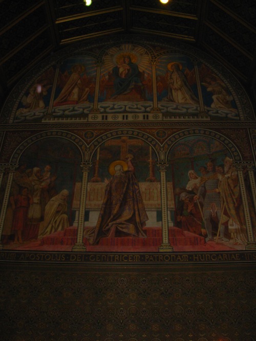
Inside the Cathederal

Another view

Artifacts from the Cathederal

Several Turkish artifacts also survived, namely three mosques, two minarets, and remnants of a bath over the ancient Christian tombs near the cathedral.

Pecs is a lovely city and I recommend a visit if you are travelling in Hungary.

Old Town Square

Before we leave Pecs and continue to Budapest I want to share this last photo and dedicate this blog to my dear friend  Dr. Mike Csovari. His kind friendship and support as a professional in the environmental remediation field is something I will never forget. So here’s to you Mike and your lovely wife, with my warm regards!

My friends the Csovari's

Alex and I left Pecs and headed to Budapest. Truly a must see city on the Danube. It is the largest city in Hungary with 1.7 million inhabitants. The Danube river divides the old cities of Buda, high on the hill and encompassing the castle district and Pest, occupying the lower lying area adjacent to the river just across from the castle.  

Budapest Panaorama

Budapest’s history starts at 89 with the formation of a Roman military camp. It has had a long and assorted history being  the center of power of the Hungarian kings, captured by the Ottomans,  the Habsburgs, the Nazi’s, the communists…yet it endures as a world class city.

alex and I stayed with his cousins Judy and Ivan Futar. My sincere appreciation for their generous hospitality. 

Alex and his Aunt

The Futar Home

Judy and Fannie Futar on the trolley

On the streets of Buda

Guarding the Castle

Another beautiful work of art

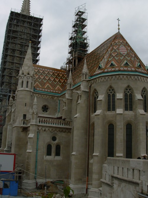
 This is called the Holy Trinity statue and is located adjacent to the Matthias Church, which has stood on this site since the beginning of the 13th century. 

The Fisherman's Bastion and statue of St. Stephan

View from the Fisherman's Bastion overlooking the Danube

Parliament in the distance

Walkway along Fisherman's Bastion

Russ

Tile Roofs and spires

St. Stephan

Mattias Cathederal

Lovely

Grand Gate

The famous Chain Bridge

Now that's a Fish!

The lower part of the city

Hungarian writer and journalist

Fannie and friend!

Unusual

Love the place

So thats it for now on Budapest. Karen and I are making plans for a return trip and there will be another blog in the future. The people here were friendly. The place is steeped in history. Great place to visit. Hope you enjoyed the tour!

Posted by: okierus1 | January 19, 2010

The Road To Tashkent (with apologies to Hope and Crosby)

The months of April , May and June of 2009 were  quite busy in terms of my travel schedule. I was in China, Mongolia, South Korea, Kyrgz Republic (2x) (can I buy a vowel?), Tajikistan and Uzbekistan ( Tashkent is the Uzbek capital and my point of departure back to Europe…hence the name of the post). Subsequently I was in Kazakhstan and Canada…but that is another story (perhaps another blog entry).  The plan was to travel to nations with aspirations of developing their uranium resources and to nations with uranium legacy sites which need remediation to advise,  and support as appropriate. China and Korea were interim stops to the Central Asian countries. The flight schedules worked out that I ended up with a little down time in these two countries and decided to see  what I could in a limited timeframe. My travelling companions were three German gentlemen ,Lutz, Uwe and Falk. We had 2 Kyrgzy national once we got to central asia, a driver named Rakhim and a translator named Dinara.

Beijing 

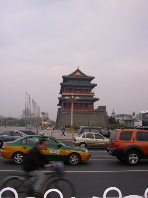
According to  Wikipedia the history of Beijing  (used to be called Peking) can be traced back 3000 years when it was the capital of the ancient state of Yan. It has been the capital of several major dynasties of China. It is the largest country in East Asia and the most populated in the world with over 1.3 billion people, approximately one-fifth of the world’s population.  It seemed to me I saw most of them in Tiananmen Square  (gate of heavenly peace) which I was able to visit late one afternoon prior to my next flight early the next morning. The population of Beijing is estimated to be 17.4 million people. The following is a few photos  before and after nightfall in Tianamen Square. 

DSCN2192 

Tiananmen is the largest public square in the world, covering over 44 hectares  For those of you too young to recall, the 1989 protest here in Beijing, was the culmination of a series of student-led pro-democracy demonstrations in China.  On June 3 and 4, 1989, the People’s Liberation Army crushed prodemocracy supporters, killing hundreds of supporters, injuring another 10,000, and arresting hundreds of students and workers. Following the violence, the government conducted widespread arrests, summary trials, and executions; banned the foreign press; and strictly controlled the Chinese press …and now friends, they are buying up American debt right and left   


Tiananmen Square

Tiananmen Square

A few more photographs….. 

Dusk in Tiananmen Square

Dusk in Tiananmen Square

Monument to People's Heroes

Monument to People's Heroes

DSCN2204


Me

Me

Mongolia 

My next stop was Mongolia.  I flew into Ulaan Baataar the capitol  (38% of total population) and then transferred to 4wd for a jaunt across the steppes to the northeast to visit some uranium exploration and former mining sites. At 1,564,116 square kilometres, Mongolia is the nineteenth largest and most sparsely populated independent country in the world, with a population of around 2.9 million people. Quite a change from China! Its about a 2.5 hour flight right over the Gobi Desert from Beijing to Ulaan Bataar. 
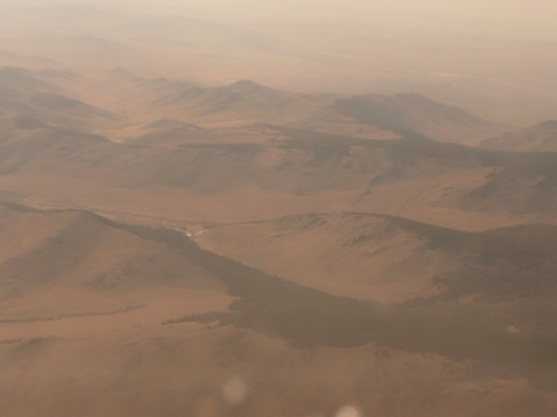
The Gobi from the Plane

The Gobi from the Plane

 The Gobi desert, one of the world’s great deserts, covers much of the southern part of Mongolia. Unlike the Sahara there are few sand dunes in the Gobi. There are large barren expenses of gravel plains and rocky outcrops. 

Another View of the Gobi

Another View of the Gobi

Precipitation averages less than 100 mm per year, while some areas only get rain once every two or three years. Strong winds up to 140 km/h make travel dangerous in spring and fall. Temperatures reach +40° C. in summer, and -40 in winter. 

Ulaan Baatar (UB) has a long and mysterious history, and is only now undergoing an industrial revolution. UB is one of the most drab looking cities on the face of the planet, a shame really, considering it’s the capital of one the most beautiful and hospitable countries on earth 

View from the Hotel

View from the Hotel

The Mongolian people which I met were very kind and gracious.  They were anxious to educate us about their culture and the history of their people in the brief time we were with them. 

Sightseeing with our Mongolian Hosts

Sightseeing with our Mongolian Hosts

Approximately 50% of Mongolia’s population follow Buddhism, 40% are listed as having no religion, 6% are Shamanist and Christian and 4% are Muslim. 

The currency unit of Mongolia is named the Tugrik . One American dollar is roughly equivalent to anything from 1200 to 1500 tugrik . 

Lutz and Uwe doing a little souvenir shopping

Lutz and Uwe doing a little souvenir shopping

The Mongolian steppes are amazingly vast. We travelled thru them in a two vehicle convoy some 600 kilometers to the region of the uranium deposits in the northeat part of the country. A steppe is a  region characterized by a grassland plain without trees (apart from those near rivers and lakes). The prairie (especially the shortgrass, think east of Albuquerque all the way to McLean, Tx.) can be considered a steppe. It may be semi-desert, or covered with grass or shrubs or both, depending on the season and latitude. The term is also used to denote the climate encountered in regions too dry to support a forest, but not dry enough to be a desert. 

The Steppes

The Steppes

More Steppes

More Steppes

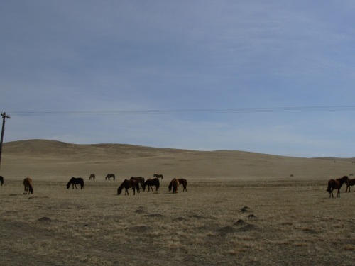
Mongolia is a nation of herders. There are more horses than people here, and about five times as many sheep and goats. There are no fences, walls or hedges. The Mongolian horse dates back about 6000 years.  This horse, known in Mongolia as the takhi, was discovered in 1881 by a Russian explorer named Przewalski, after whom the horse became known.   


More Horses

More Horses

By the end of the 1960s the horse had become extinct in the wild, but thanks to breeding reserves in Europe it was reintroduced to Mongolia in 1992.  
Mongolian Horses

Mongolian Horses

Herds roam across the grasslands,  horses galloping freely. Mares are generally not ridden in Mongolia.  Instead they are used for breeding and producing Mongolia’s national beverage airag, which is fermented mare’s milk and has a mildly alcoholic content…..and tastes like it sounds! 

Herdsmen

Herdsmen

Mongolian gazelles are active during the daylight hours of fall and winter, mostly grazing in the mornings and late afternoons. They will excavate a depression bed within bushes in order to shelter themselves from winds and harsh weather. Being very fast animals, they are able to run up to 40 mph (65 kph), sustain this speed for 7–9 mi (12–15 km), and can leap up to 6.6 ft (2 m) into the air. They also are good swimmers, and can easily cross wide rivers. Large-scale migrations are regularly taken by this species. Herds of 6,000–8,000 animals of both sexes gather in the spring where they begin their northerly migrations for food and to drop young, often covering 120–180 mi (200–300 km) in a day. When reaching summer pastures in June, the sexes will isolate themselves and females prepare to give birth. Herds generally use several hundred square miles (kilometers) as their summer home range, regularly shifting areas in the search for food. During the winter, herds normally number no more than 120 animals. Sometimes single-sex herds of 20–30 animals will gather 

Mongolian Gazelle ... look like antelope to me!

Mongolian Gazelle ... look like antelope to me!

Probably Mongolias most famous citizen, Genghis Khan came to power by uniting many of the nomadic tribes of northeast Asia. After founding the Mongol Empire and being proclaimed “Genghis Khan”, he started the Mongol invasions and raids . During his life, the Mongol Empire eventually occupied a substantial portion of Central Asia 

Born with nothing, he rose to become the most powerful man of his time, conquering nations to build the largest empire the world had ever seen. 

Genghis Khan

Genghis Khan

Before Genghis Khan died, he assigned Ogedei Khan as his successor and split his empire into khanates among his sons and grandsons. He died in 1227 after defeating the Tanguts. He was buried in an unmarked grave somewhere in Mongolia at a location unknown. 

Genghis Khan (1162-1227)

Genghis Khan (1162-1227)

His descendants went on to stretch the Mongol Empire across most of Eurasia by conquering and/or creating vassal states out of all of modern-day China,Korea the  Central Asian countries, and substantial portions of modern Eastern Europe and the Middle East. 

Nearly all herders live in white gers (felt-lined tents, yurt in Russian), a characteristic sight throughout Mongolia. Each family has their own ger. 

Inside the Ger (yurt)

Inside the Ger (yurt)

A ger is a herder’s most important possession. When a couple gets married the family builds or buys them a new ger. This family has bought the lattice work, but they make the felt covering themselves. 

The Structure

The Structure

Gers are easy to put up.  The lattice work forms the wall, and supports the long roof poles, which come together at the central ring. The door always points to the south. 

Our Ger (yurt)

Our Ger (yurt)

It even had wireless internet!!!!! 

Dear John...you won't believe this....

Dear John...you won't believe this....

The Ger C-5 Team

The Ger C-5 Team

These Gers are in a uranium exploration camp called Gurvanbulag. The place had everything, central bathhouse, cafeteria, internet…very decent accomodations. At the time it was owned by a Canadian company…they are awaiting approval of some regulatory documents and plan to produce thru in-situ leach and some conventional underground mining. 

Headworks

Headworks

The shaft is flooded and will have to be pumped out. These ponds willact a settlement basins. 

Lined Ponds

Lined Ponds

Some small waste piles exist at the site 

Waste Piles

Waste Piles

After visiting this site we then travelled to Dornod via the nearly ghost town of Mardai approximately 30 km away. 

As we approach Dornod you can see the open cut where the uranium ore was excavated . The pit is flooded. 

Uranium Mine Site

Uranium Mine Site

The site was operated by Khan which was a joint Mongolian Govt/Canadian/Russian venture (as can be seen by the flags)…the Canadians are no longer partners. 

Group Photo Uranium Mine site-NE Mongolia

Group Photo Uranium Mine site-NE Mongolia

A quick 140 km over two track roads and we are at the Choilbalsan airport where we depart for Ulaan Baatar. After some discussions with hosts we departed for Korea. 

Seoul , Korea 

The flight in over the Yellow Sea is beautiful to say the least. 

View from the plane near Seoul

View from the plane near Seoul

 Korea has existed as a  state or collection of states  almost continuously for several millennia. Korea was formed from the  unification in the 7th century  from three predecessor states. Korea existed as a single independent country up until the 20th century. In 1905, following the Russo-Japanese War, Korea was a protectorate of Japan, and in 1910 it was annexed as a colony. Korea regained its independence following Japan’s surrender to the United States in 1945. After World War II, a Republic of Korea (ROK) was created in the southern half of the Korean Peninsula while a Communist-style government was installed in the north (the DPRK). During the Korean War (1950-53), US troops and UN forces fought alongside soldiers from the ROK to defend South Korea from DPRK attacks supported by China and the Soviet Union. An armistice was signed in 1953, splitting the peninsula along a demilitarized zone at about the 38th parallel. Thereafter, South Korea achieved rapid economic growth. The north hasn’t fared so well. 

Seoul is the capital and largest city of South Korea. With a population of over 10 million, it is one of the world’s largest cities. The metropolitan area has 24.5 million inhabitants, and is the world’s second largest. Almost half of South Korea’s population live in the Seoul National Capital Area, and nearly a quarter in Seoul itself, making it the country’s foremost economic, political, and cultural center.  

 Located on the Han River,i n the center of the Korean Peninsula,  Seoul has been a major settlement for over 2,000 years, with its history dating back to 18 BC, when  one of the three predessor kingdoms of Korea established its capital in what is now south-east Seoul. The city then became the capital of Korea during the Joseon and the Korean Empire. As the center of Korean history over the past millennia, the Seoul National Capital Area is home to four UNESCO World Heritage Sites: Changdeokgung, Hwasung  Fortress, Jongmyo Shrine and the  Royal Tombs of the Joseon Dynasty.  

 I was fortunate to see a bit of Seoul in our brief stopover (the weekend).  We decided to go on a world cultural heritage tour of the city. The tour was fantastic! We visited Changdeokgung Palace, the Jongmyo Royal Shrine, the Ginseng Center (no photos top secret), Jo-Gye-Sa Buddist Temple, the Amethyst factory, the Suwon HwaSung Fortress,  and the Namdaemun Market ! So lets take a look: 


Our Guide

Our Guide

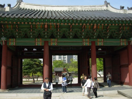
Changdeokgung Palace    


Palace Entrance

Palace Entrance

Injeongjeon-Throne Hall

Injeongjeon-Throne Hall

Inside View of Throne Hall

Inside View of Throne Hall

Throne
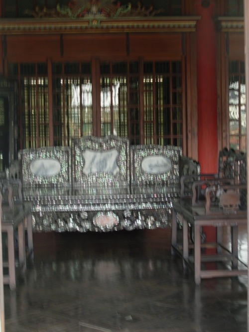
Throne

Silver Furniture

Silver Furniture

Beautiful Architecture

Beautiful Architecture

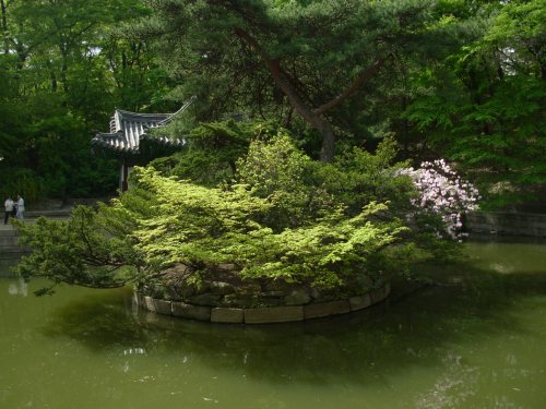
Scenes from the Palace Grounds
Scenes from the Palace Grounds

Me

Me

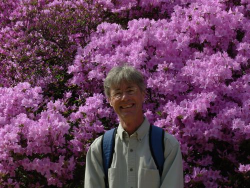
Azaleas

Azaleas

Almost a Postcard

Almost a Postcard

Classic Structure

Classic Structure

Rooftop

Rooftop

Nice Landscaping!

Nice Landscaping!

I like this place so much, I thought I would post it twice!

I like this place so much, I thought I would post it twice!

Serene

Serene

Me Again!

Me Again!A Kodak Moment

Quiet Beauty

Quiet Beauty

Japanese Maples

Japanese Maples

Azaleas

Azaleas

Buddhist Temple 

Nearing the Temple

Nearing the Temple

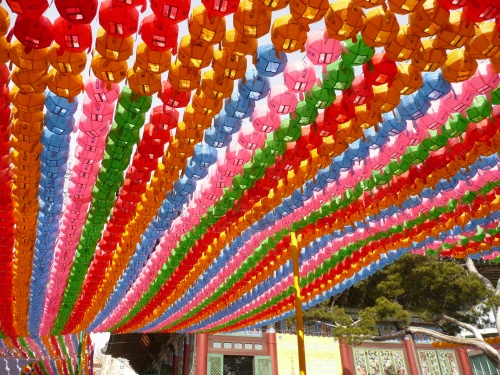
Lanterns, Columns and Beams

Lanterns, Columns and Beams

Buddha

Buddha

Shrine

Shrine

Beautiful

Beautiful

Spectacular

Spectacular

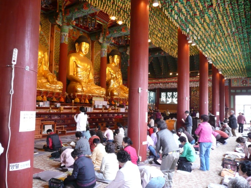
Inside the Temple

Inside the Temple

The Faithful

The Faithful

Jongmyo Royal Ancestral Shrine 
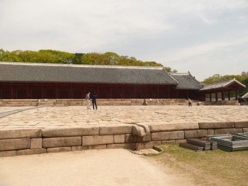
Royal Ancestral Shrine

Royal Ancestral Shrine

 More Jongmyo

More Jongmyo

Jongmyo Joseon Dynasty 1392-1910

Jongmyo Joseon Dynasty 1392-1910

Hwasung Fortress 

Wall of the Fort

Wall of the Fort

Old and New

Old and New

Again..old and new

Again..old and new

No Shoes

No Shoes

The Fort

The Fort

Showtime !

Showtime !

Royalty

Royalty

Soldiers

Soldiers


Archers

Archers

The Namdaemun Market 

The Market

The Market

Fresh Produce

Fresh Produce

Nice Fish

Nice Fish

Attention K-Mart Shoppers!

Attention K-Mart Shoppers!

Our Hotel

Our Hotel

Room with a View

Room with a View

Seoul at Night

Seoul at Night

Next Stop….Central Asia 

I don’t know about most of you , but I could not have told you what countries are in Central Asia  as of 18 months ago. I have learned a little since then but still have much more to learn. Check out the map below: 
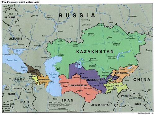
  800px-Caucasus_central_asia_political_map_2000 

Central Asia is a facinating place with a long and rich history. I travelled from Seoul Korea to Bishkek Kyrgyzstan by air. Then transferred to 4wd and drove to several locations in the country, crossed into Tajikistan visited several uranium sites and ultimately ended up in Uzbekistan for the same purpose. (If you happen to be reading this blog and helped arrange this trip..I am in your debt!). The people were very kind and gracious ..and have endured much. I will always be grateful for this opportunity and will never forget these experiences. 

Kyrgyzstan 

The name of the country is a derivation of a word from the Turkic meaning forty tribes.  Their epic hero Manas unified 40 tribes to repel an enemy invasion (the Khitans).  This is reflected symbolically in their flag with the depiction of the 40 ray sun. 


Bishkek is the capital and also the political, economic and cultural center of Kyrgyzstan. The city was a caravan station on the Silk Road  thoughout its history has had several renamings. Today it has about 900,000 inhabitants. 

As a caravan station on the silk Road it lie on a  path which emerged from the Tian Shan mountain range, which separates it from China. In 1825 it was known as the Uzbek Khan of Kokand  which was a state in the Ferghana valley, but it was taken in 1862 by Russian soldiers during the Russian conquest of Central Asia and destroyed. The Russians , founded a garrison and the population was increased by the influx of Russian peasants, anxious to farm the famous black soil.  In 1878 a city with the name was Pischpek founded. 

In 1926 she became the capital of the newly formed  Kyrgyzstan, and simultaneously renamed Frunze  after a close confidant of Lenin, who was born there and fought during the revolutions of 1905 and 1917, and in the Russian Civil War of the 1920s had a decisive role. 

After the collapse of the Soviet Union, Kyrgyzstan became independent in 1991, when the Kyrgyz Republic, and the city regained its Kyrgyz name of Bishkek. 

Tian Shan looming above Rooftops

Traditional young Women-Photo from poster
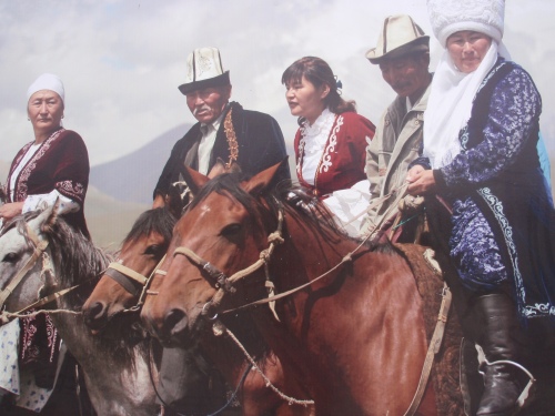
The People of Kyrgyzstan

The two preceeding photos above are from posters on display in the main square. I just liked them! 

National Arts Theater

View from the Hotel

Park in Bishkek

Roadside Market-Traditional round Flatbread called Nan

Magnificient View

Kyrgyz Cattle Drive

Friendly Elderly Gentleman

Snowy Range

Fish and Furs

High Country

En Route to Minkush

Minkush-former uranium mining site

Welcome to Minkush !

City Hall Minkush
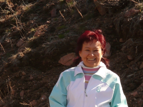
Our Translator- Dinara

Mountain Stream
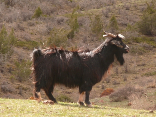
Goat posing for Photo

Rock, Lichens, Graveyard, Mountains, River, Waste Dump

Small Village near Minkush

Villagers
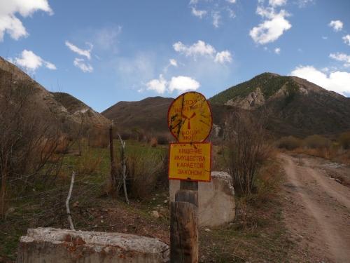
Uranium Mill tailings dumps-Mailu Suu

Lenin

Lodging

Lenin

Nice Geology

Angle of Repose?

The Gas Station (actually diesel)

The Beautiful Naryn River

Lake formed by Dam on Naryn River

Wildflower

Poppies

School girl near Mailu Suu

Villager picking thru waste pile from light bulb factory harvesting tungsten filaments

Starbucks Kyrgyz style !

Having visited the uranium mining legacy sites of Minkush and Mailu Suu we headed for Tajikistan to gather information on Degmai and Taboshar which are also mining and milling waste sites left behind by the Russians. One final note about these Kyrgyz sites. They are located on steep mountain sides in areas that are seismically very active and prone to earthquakes and land/mud slides. They are located in the upstream drainage basin of the Syr-Darya river which flows in Tajikistan and Uzbekistan through a very populated agricultural area known as the Ferghana valley. These countries are very poor and have a modest infrastructure, let alone the resources for a large scale environmental remediation. In discussions with the regulatory authorities they make less than $50 usd per month. While the radiological hazard is more localized there may be transboundary toxic metal contamination. Much more work is needed in these areas in terms of risk reduction to human health and the environment.

Tajikistan

Tajikistan (pronounced /təˈdʒɪkɨstæn/ or /təˈdʒiːkɨstæn/; Тоҷикистон IPA: [tɔd​͡ʒikɪsˈtɔn]), officially the Republic of Tajikistan (Tajik: Ҷумҳурии Тоҷикистон, Jumhurii Tojikiston), is a mountainous landlocked country in Central Asia. Afghanistan borders it to the south, Uzbekistan to the west, Kyrgyzstan to the north, and People’s Republic of China to the east. Tajikistan also lies adjacent to Pakistan but is separated by the narrow Wakhan Corridor.

Most of Tajikistan’s population belongs to the Tajik ethnic group, who share culture and history with Afghanistan and speak the Persian language (officially referred to as Tajiki in Tajikistan). Once part of the Samanid Empire, Tajikistan became a constituent republic of the Soviet Union in the 20th century, known as the Tajik Soviet socialist republic (Tajik SSR). Mountains cover over 90% of this Central Asian republic.

After independence, Tajikistan suffered from a devastating civil which lasted from 1992 to 1997. Since the end of the war, newly established political stability and foreign aid have allowed the country’s economy to grow. Trade in commodities such as cotton and aluminium wire has contributed greatly to this steady improvement. In Tajikistan about 20% of the population lives on less than US$1.25 per day.

On the way to Tajikistan we encountered a dust storm about the same time we had a flat. We stopped in a local village. While our driver Rakhim took care of the flat my associates and I located the nearest refreshment stand. This is where I made two new friends.

Dust Storm

My Friends!

Falk, Rakhim and me on the job!

Riding Double

Kyrgyz-Tajik Border

Our Hotel in Khujand

The Luxury Suite

A Feast

A Mosque

Another Mosque

The Market (Bazaar) in Khujand

Dried Fruits and Nuts

the Butcher Shop Boys

The Merchant

The Young Vendor

Tajik men passing the day
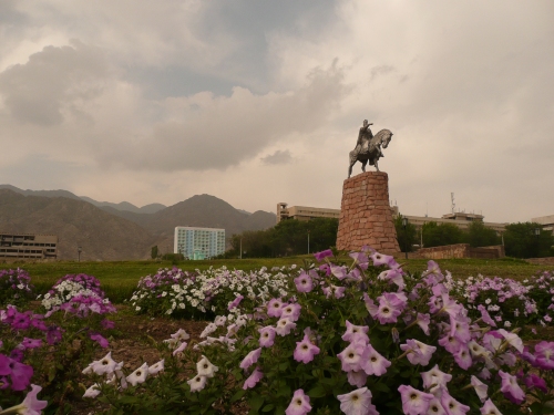
Somoni Founder of Tajikistan

Tajik Bride and Groom placing flowers at the Monument for Somoni

The Cops

At the Market

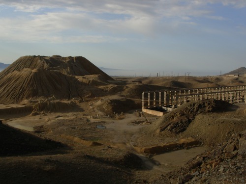
Now a few photos of the uranium legacy sites. These sites are uncontrolled as far as access. The process involves mining ore, crushing it, leaching the uranium out. It produces a tremendous volume of waste. Left to the elements it edrodes, gets used as building material, seeps into water supplies etc. I saw livestock grazing on these waste piles, evidence of children playing on them, people watering their gardens…it made my heart ache..its why I do this job..to try and make a difference.

"Yellow Hill" Taboshar
Acid Leach Tanks Taboshar

The Pit where the uranium ore was excavated

  Uzbekistan

Uzbekistan, a country in Central Asia, formerly part of the Soviet Union. It shares borders with Kazakhstan to the west and to the north, Kyrgyzstan and Tajikistan to the east, and Afghanistan and Turkmenistan to the south.

Once part of the Persian Samanid and later Timurid empires, the region was conquered in the early 16th century by Uzbek nomads, who spoke at Eastern Turkic language. Most of Uzbekistan’s population today belong to the Uzbek ethnic group and speak the Uzbek, one of the family of Turkic languages.

Uzbekistan was incorporated into the Russian empire In the 19th century and in 1924 became a constituent republic of the Soviet Union. It has been an independent republic since December 1991.

Uzbekistan’s economy relies mainly on commodity production, including cotton,gold,uranium, potassium, and natural gas. Despite the declared objective of a transition to a market economy, Uzbekistan continues to maintain rigid economic controls, which often repel foreign investors. The policy of gradual, strictly controlled transition has nevertheless produced beneficial results in the form of economic recovery after 1995. Uzbekistan’s domestic policies on human rights and individual freedoms are often criticised by international organizations.[ In Uzbekistan about 45% of the population live on less than U.S. $ 1.25 per day.


Tashkent

 I hope you enjoyed this blog and it gives you a little glimpse into some far away places. I would have uploaded some more on Uzbekistan but the batteries I bought for my camera were dead right out of the package! If you ever have a chance to visit these places I strongly recommend it.


And the final photo….

Some well deserved rest!


Posted by: okierus1 | January 17, 2010

Our First US Visitors

My mom and my neice Sarah came for a visit at the end of May, our first guests from home!  Sarah has just graduated from University, so this was a great way for her to relax before starting graduate school this fall.  We spent a lot of time on Stephansplatz, and took the tour of the crypts under the Cathedral.  Many of the royal family are there, as are urns with some of their internal organs.  Also quite a few of the religious hierarchy.  They are under the Cathedral proper.  Just outside the footprint of the Cathedral are more bones.  Stacks and stacks of bones, and at one point just a pile, there were so many that died during the plague years they couldn’t keep up with civilized burials.  (I am going to do a plague blog, when they finish construction near the plague monument.  Stayed tuned, you public health nuts.)

We took a day trip to Durnstein too.  I know we have posted on Durnstein before, but here are a few more photos from that day.  It is a great little town.

Part of the old wall still around the city

Part of the old wall still around the city

The church tower

The church tower

We walked around a bit and at one point ended up in  a tourist shop filled with french tourists.  Three old ones kept yelling – in french – “what country is this?  What country is this?” at the flustered shop keeper.  I think they must have been on the “eight countries in five days” tour.  We had lunch at the Blondel Restaurant.  The food there is great, as is the landscaping and gardening in the outdoor restaurant. 

Very nice street light

Very nice street light


Jesse and Sarah coming into Durnstein

On the Danube River

Durnstein from the River

That castle on the hill was where they kept Richard the Lionhearted locked up, until his “faithful minstrel” Blondel found him there.

Next stop:  Florence, Italy!  This was the most amazing city.  Everything we ate was fantastic, didn’t matter lunch, breakfast, snack, fast food, slow food, it was all wonderful.  Now I know what people are talking about when they rave about gelato, we had to eat that about 3 times a day.  I don’t know what they do differently, but it beats the pants off of regular ice cream.  This photo is of breakfast one morning, after we lost mom and were waiting for her to reappear.

"The Best Pizza Ever!"

This brass model of the city was in this plaza, the Piazza della Repubblica.  Home of the Best Pizza Ever, as well as a fantastic gelato stand.

Firenze

 The guide book Time Out Italy describes Florence thusly:  “Florence itself is one enormous museum and gallery, with more art treasures per square meter than any other town on the planet”.  Even when  you weren’t in a gallery, you were surrounded by art.

OLD stone lion

Street lamp base

(That’s the Ponte Vecchio in the background, over the River Arno)

Fleur de Lis on a lamppost

The Fleur de Lis is the symbol for my two favorite cities ever – Firenze and New Orleans.

Even the construction barriers are lovely here.

Construction barrier outside the Uffizi

And where there was no artwork to be seen, the chalk artists came and fixed that.

On the street

I liked this truck.

Chianti truck by an old wall

Here are some of the statues we saw, both in and out of museums.

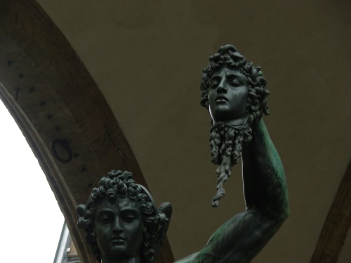
Medusa's Head, in the Loggia del Lanzi

The Loggia del Lanzi was between the Uffizi and the Piazza della Signoria.  It had places to sit in the shade (even in May it was very hot), where you were surrounded by classic statues.  It was a great people watching spot.  Lots of art classes sitting there too, drawing all sorts of things.

Hercules and the Centaur, circa 1599

on the Loggia

and for the Razorback fans among you:

Classical Hog

Even though we have all seen this image over and over, seeing the real thing was almost overwhelming.  It is simply beautiful.

in the Accademia Gallery

Michelangelo was supported in his career by Medici family.  This family ruled Florence for centuries, and many of the artworks that we see now were comissioned by the Medici’s.  This is their family crest:

Medici Crest

Leonardo da Vinci and Brunelleschi were some of the other artists commissioned by the family.  Brunelleschi lives on in the Duomo – the Dome of the Santa Maria del Fiore basilica.  It was amazing.

the Duomo

the front door

 Jesse and I walked up about 10,000 stairs up to the inside of the Duomo.  It is covered in Vasari and Zuccari’s “Last Judgement”.  I apologize in advance for the quality of the next photos, my camera didn’t do so well in the very low light, but it was quite an amazing sight.

the losers

and the winners

And we finally made it all the way up and out.

Firenze!

Here is the Santa Maria de Novella

This church also (of course) is filled with amazing artwork.  When Jesse was in 8th grade, her grade took a field trip to Florence.  They were all assigned a piece of art and had to research both the piece and the artist.  Jesse had the Trinity Fresco, by Masaccio.  He was apparently the first one, in this piece, to paint using perspective.  Anyway, the kids toured the city and when they came upon their art piece, had to stand and deliver their paper, in front of the class and all the tourists.  I made Jesse do hers again for us, while we were standing in front of the Trinity.  I enjoyed it more than she did, but she actually learned quite a bit about a lot of the art we saw on this trip.

We walked along the River Arno quite a bit, trying to find our way to the various galleries.  It’s a quiet kind of river.

Across the river

the Ponte Vecchio

This bridge has survived since 1345, and was the only one not damaged by German bombs in 1944.  It was the butcher shop bridge until the 1500’s, when those shops were replaced by gold shops.  They are still here, and it is pretty bedazzling to walk across the bridge these days.

view down river from the Ponte

the cousins livin' La Dolce Vita

I was offered a fair amount of money for Sarah here, or at least a trade for a suspect piece of art, but I decided in the end to hang on to her.  Finally, here are just some scenes from around town.

Butcher shop

(and why are there stuffed woodchucks sitting at the table!?)

Street plaque for Savonarola

He seemed like a pretty sinister guy, from what I have read, but there are still people laying flowers here for him, and weeping.

looks like Gieppeto's workshop

the floor in our pensione room

rooftop view from our room

I loved it and would go back in a second.  Who wants to go with me?

Posted by: okierus1 | July 5, 2009

Carnuntum

Happy 4th of July all !!! Not a big holiday here in Austria as you can imagine. So Karen and I decided to take a little road trip with our friends Jerry and Cynthia (fellow New Mexicans) to Carnuntum, an ancient Roman ruin complex. It is located on the Danube River between Vienna and Bratislava. Some of the sites include remnants of amphitheaters, public baths, houses, monuments and an excellent museum. It was established in 6 A.D. as a military outpost.

House Foundations and Reconstructed Villa

House Foundations and Reconstructed Villa

Carnuntum eventually increased to a population of over 50,000 and became the capital of  Upper Pannonia, a province of the Roman empire.  One of the interesting features here is you can contrast the ruins with reconstructed buildings which have been restored using materials, techniques and styles of the period.

The Romans were quite the engineers. In the photo below you can see the underfloor heating system. A fire was built in a chimney outside and the heat was drawn thru a crawlspace under the floor and out thru ceramic pipes in the wall. The stone structure had mass and retained the heat quite nicely.

Heating System

Heating System

 The  house below is the reconstructed home of the wealthy cloth merchant Lucius. It illustrates the luxurious life led by the Roman upper classes.

Cynthia, Jerry and Karen outside the reconstructed villa

Cynthia, Jerry and Karen outside the reconstructed villa

We were amazed at how beautiful the interior could be, all the comforts of home.

The Bedroom

The Bedroom

Carnuntum was located on what was known as the “Amber Road”. This was an important trade route between the Baltic region and the Mediterranean .

The Dining Hall

The Dining Hall

Emperor Marcus Aurelius resided in Carnuntum during  his wars against the Germanic tribes of Marcomanni and Quadi between 171 and 173 AD. He wrote  portions of his bookMeditationshere.

Lion

Lion

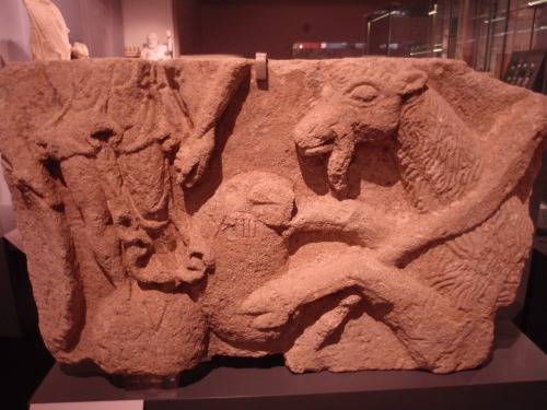
The museum houses many artifacts and works of art. The city must have been quite beautiful decorated with statues, reliefs and mosaics.

Example of a Relief

Example of a Relief

The entry fee for the complex, including the museum, is nine euros for adults and well worth it. This one time fee is valid for the season.

Triton

Triton

Panonnia was finally abandoned by the Romans around 400 AD . Carnuntum fell under disrepair as thousands of the town′s residents left. Today, the modern (well, sort of ) village of Petronell-Carnuntum has grown around the Antique ruins.

Figure in Repose

Figure in Repose

The highlight of Carnuntum and its trademark is the “Heidentor” (“Pagan′s Gate”). This enormous triumph arch was built outside the town and now stands in the middle of the fields.

Pagans Gate

Pagans Gate

This was once a monument constructed in honor of Emperor Constantius II.

Heidentor with Model in Foreground

Heidentor with Model in Foreground

Finally a photograph of the exterior of the museum with a statue of the Austrian  Emperor Franz Joseph to the left.

Joe and the Museum

Joe and the Museum

Posted by: okierus1 | June 25, 2009

A Trip for Wine

In March, we went with Denis and Lynn Wymer, and their visiting son Duncan, to two of their favorite wineries on a wine buying trip.  The people on the field trip that day were John and Yvonne LeHeron from New Zealand, Virgina Koukouliou from Greece, Herr  Manfred Draudt from Austria, us from the US, and the Wymers are from South Africa (and their son just moved to Italy).  I love that about living here, every gathering is like the UN.

In the Keller

In the Keller

We headed north in a little caravan, through a lot of farm country.  There were deer in the fields, and I now know where the term “wild hare” comes from.  There are huge rabbits here, I think they actually are hares, and they were in the throes of love.  Packs of them in the fields, leaping, jumping, throwing themselves into the air, flipping about.  Pretty silly looking.  They probably weigh more than Astro and he is about 20 pounds.

We first went to a place in the town of Kalladorf, called Weingut Burger.  They are known for their red wines, not the usual here in Austria.  We bought their Cuvee and their Blauburger, both very good.  We ate lunch there in a beautiful old restaurant.   Then it was off to the Weinbau Josef Schneider, in Straning.  (That’s where we finally remembered we had the camera.)

Herr Schneider was very happy to see us, he and the Wymers have been friends for a while now.  He took us to his Keller, and served us lunch there (we did eat a lot of lunch that day), all made by his wife.  He gave us a tour, and we were able to sample from the huge wine casks there.  His Gruner Veltliner was his specialty.  That is actually the most common grape grown here, about 70% of the grapes I have heard.  His was excellent.

One of the cellars in

One of the cellars in Straning

Stacks of Gruner Veltliner

Stacks of Gruner Veltliner

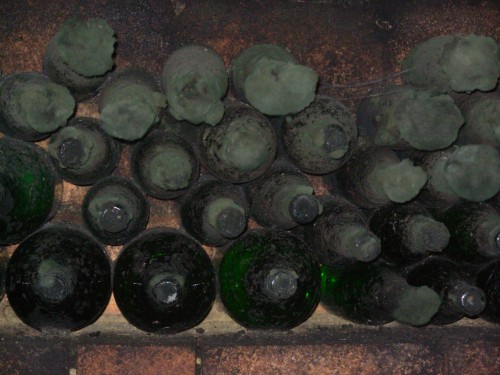
There is fungus that grows on the bottles in the Kellers, if they are left there for some length of time.  People say those are the best wines, but I’m not sure I could get through the  growth.  They call it “Keller Katzen”, cellar cats.

Keller Katzen

Keller Katzen

These are more like Keller Kittens at this point

These are more like Keller Kittens at this point


Wine casks in the Keller

Wine casks in the Keller


Herr  , Virginia, and Herr Schneider

Herr Draudt, Virginia, and Herr Schneider

Herr Scheider getting a sample from a cask

Herr Schneider getting a sample from a cask

These places are old, and most have been in the family for generations.  Herr Schneider’s family had been doing this for a couple hundred years now.  We were mostly in the new cellar, which dated from 1839.

A beam in the new cellar

A beam in the new cellar

He also had the old cellar across the road, he wasn’t sure if it was 300 or 400 years old.  They don’t use that one for wine, but do rent it out for parties and receptions.

In the old Keller

In the old Keller

This is the outside of the Keller the wine is in.  When I told him I was a Meyers, he gave me a free wineglass because that meant I was Austrian even though noone, including me,  knew it.

Cellar doors

Cellar doors

You can see the Wein Meister, with his wine sampler in the painting.  It was one of the first nice days this past spring, and we had a great trip.  Denis, we’re looking forward to the next outing!

Posted by: okierus1 | March 21, 2009

Hallstatt and the Grossglockner

One of the most enjoyable outings we have had so far took place in October of 2008. After checking the weather report ,we decided to take a road trip to the beautiful village of Hallstatt deep in the alps and traverse the Grossglockner, the high alpine road which winds thru the Alps. This late in the fall we were well past tourist season and in large part had the area to ourselves, a rare treat we were told.

The village of Hallstatt is about a three hour drive west northwest from Vienna.   It is located in an area called the Salzkammergut. The steep Dachstein massif provides a beautiful backdrop for the village which is nestled at its base on the shores of the Hallstatt See.

Halstatt

Hallstatt

 This little lakeside village has been an area of civilization since the Neolithic Stone Age, a result of the precious salt discovered in its hills. Because of archeological discoveries in the Hallstatt burial grounds, the Early Iron Age (800BC – 400BC) is called The Hallstatt Period.

Russel lakeside wishing he had brought his fishing pole!

Russel lakeside wishing he had brought his fishing pole!

The village consists of a series of terraces and a few scores of quaint little houses on the hillside.

View of Halstatt

View of Hallstatt

 Many gasthofs line the shore of Hallstatt See. You can get a room right on the water. It is amazingly beautiful and at this time of year peaceful as well. A ferry crosses the lake periodically to retrieve visitors arriving by train on the far shore of the lake.

Karen relaxing next to the gasthof

Karen relaxing next to the gasthof

Hallstatt is the type locality…for all you Celtic history buffs… for the Hallstatt Period of European Celtic History dating from about 2200BC. because of the discovery of about five thousand Celtic graves dating from that period in and around the Salt Mine. the Salt mine is located in the mountainside above and behind the village. It is now a tourist mine and a blast to go into. Named the  Salzwelten Hallstatt – it is reportedly the world’s oldest salt mine. A steep funicular railway takes you up the hillside to this amazing place. What is a funicular railway you may ask?

Funicular Rail cars about to pass to and from the salt mine

Funicular Rail cars about to pass to and from the salt mine

The basic principle of funicular operation is that two cars are attached to each other by a cable, which runs through a pulley at the top of the incline. Counterbalancing of the two cars, with one ascending and one descending the slope — especially when transporting similar loads, such as passengers — minimizes the energy needed to lift the ascending car

View from the upper funicular car. A long ways down!

View from the upper funicular car. A long ways down!

The mine  is famous for the Man in Salt. The corpse of this Celtic salt miner – about 2500 years old – was discovered in 1734 preserved in a salt deposit, along with clothing and tools.

Mine Entrance

Mine Entrance


Celtic Miner and Tour Guide

Celtic Miner and Tour Guide


After a short walk through a pine forest containing prehistoric tombs, we put on a helmet and mining clothes and experienced the longest wooden slide in Europe. It was quite a thrill, flying by the seat of our baggy  pants down this two-part, 64-metre-long chute at speeds reaching up to 40 kmh!

2008-10-28-027

There are various salt chambers to explore, including one containing a subterranean salt lake. Until the early Middle Ages, salt was mined exclusively in rock form. Then came solution mining, achieved by pumping in fresh water to dissolve the salt. The brine was scooped out with buckets or piped to Hallstatt. These days it’s pumped to a modern salt plant out of town.

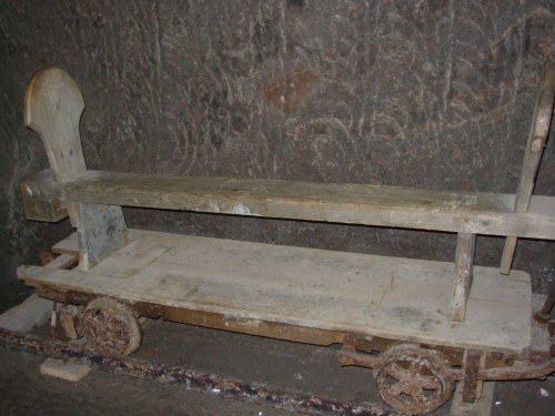
A ride on a mining train is included in the guided tour.

Antique Mine Train

Antique Mine Cart

Illuminated Salt Crystals

Illuminated Salt Crystals

 The views from the tram ..funicular rail car were spectacular!

Hallstatt See

Hallstatt See

Beautiful Hallstatt

Beautiful Hallstatt

Main Street!

Main Street!

Love those Alps!

Love those Alps!

 GROSSGLOCKNER

We reluctantly left Hallstatt to continue our adventure which would take us over some of the highest roads in Austria. The Grossglockner High Alpine Road was officially opened on 3 August 1935. Some 870,000 cubic metres of earth and rock were moved in the 26 months of building, 15,750 cubic metres of walls were created, 67 bridges built and a road telephone with 24 facilities was installed.  The 3,200 constructed features required 1.8 million work shifts.

The total building costs, according to the final calculations from 16 April 1936, amounted to the 53.5 million euro at the currency of today for the road building, 3.3 million euro for improvement of the approach roads, the telephone facilities and various details. And folks..it is worth every single euro!!!

Up the Grossglockner

Up the Grossglockner


Alps

Alps


Alpinist Paradise

Alpinist Paradise

Textbook Glaciation

Textbook Glaciation


Following the start of the Second World War on 1 September 1939, there was a drop in the flow of annual tourists, which had  risen to  375,000 During the war years between 1940 to 1944, a total of only 27,000 people visited the Glockner Road.

One happy geologist!

One happy geologist!


Karen,Jesse and Astro

Karen,Jesse and Astro

 
The Glockner Road suffered severe damage through the use of tanks, inexpert snow clearing by the occupying forces, and by the scattered refugees in the confusion of the war years as well as severe weather conditions. Thus the first task after liberation in 1945 was the repair of the road to improve public safety.

Mountain View

Mountain View


From 1949 the flow of visitors on the Glockner Road again clearly increased. The average frequency of visitors from 1949 to 1952 increased annually by 45 per cent, and the toll incomes by even 58 per cent. It was said that tourists would come up and watch the workers performing improvements on the road.


The Road

The Road

 
Eventually the road was  widened from 6m to 7.5m – in all valley locations to 8m –  the radius of the bends extended from 10m to 15m and the average speed  was increased from 40 to 70 km per hour, parking spaces for 4,000 in place of 800 vehicles was constructed, and thus  the capacity of the road increased to 350,000 vehicles. the labor was intense and much perfomed manually under difficult conditions. It was said that the workers became very annoyed with comments from spectators and tourists such as “working in a beautiful landscape and healthy mountain environment”

Remnants of a Glacier

Remnants of a Glacier

The Top

The Top

Avalanches and rock falls and  toll points are all hazards likely to be encountered during this drive.

Karen, Jesse,Glacier

Karen, Jesse,Glacier

It is a magnificent drive. There are awesome hiking/biking opportunities.

« Newer Posts - Older Posts »

Categories